


 Feed
Feed Scan with QR Code Reader
 mobi
mobi- Advertise / Donate
Welcome !
Newquay weather receives over 1000 vistors per day winter time, rising to over 3000 to 4000 or more in the summer, including visitors from all over the world.
Please help support this site

Your business

Via Paypal
- Accommodation
Hotels, B&B's and Caravan and Camping Sites

Porth Sands - Luxury beach accommodation wth beach facing balconies, a golden sandy beach making it the perfect place to idle away the hours- swimming, body boarding, sunbathing and paddling.

Stay in Cornwall - Stay In Cornwall is a great resource for people visiting Newquay and the whole of Cornwall, featuring a wide selection of hotels, self-catering cottages, holiday parks, B&Bs, and visitor guides.
- Charity Events
Charity Events - Max 3 free ads
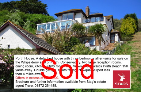
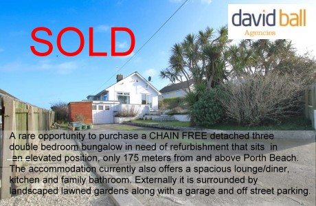
For a Free Charity Ad Here, please contact me- - Houses for Sale
Houses for Sale
Advertise your house for sale here and help support this site.
Small photo, text + link to agents for a One off ₤25. Please contact me.Advertise your house for sale here
- Local Services
Shops, Services etc

Body BounceBody Bounce bouncy castle park in Newquay. Great fun, fantastically priced and we are open during the warmer months weather depending. (Postcode for SATNAV: TR7 2QF). Body Bounce also provides private bouncy castle hire. Check out our full range at Body-Bounce
- Online Guides
Online Guides to Newquay
ESA - Observing the Earth News
| The European Space Agency (ESA) is Europe�s gateway to space. Its mission is to shape the development of Europe�s space capability and ensure that investment in space continues to deliver benefits to the citizens of Europe and the world. | |||||||||||||||||
|
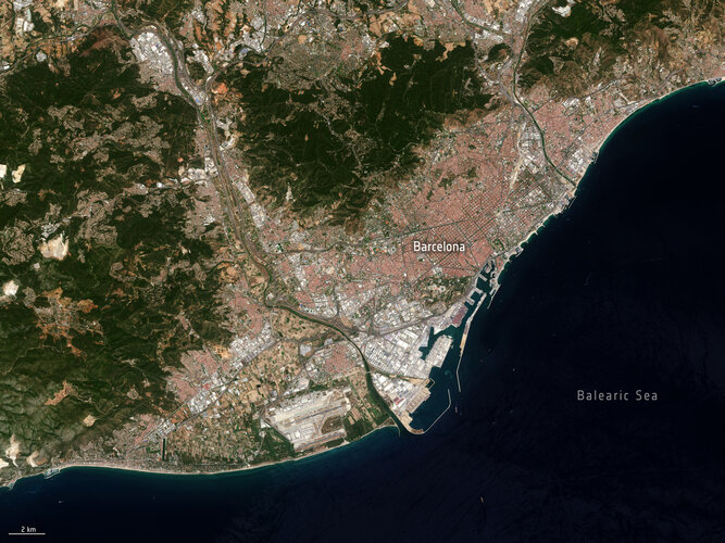

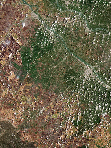 Image:
Earth from Space: The Mekong Delta
Image:
Earth from Space: The Mekong Delta 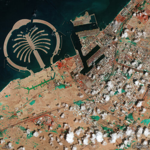 Image:
Dubai floods seen from space
Image:
Dubai floods seen from space

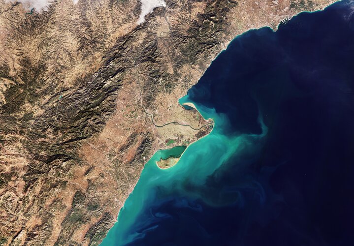 Image:
This Copernicus Sentinel-2 image shows the delta of the Ebro River on the northeast coast of Spain.
Image:
This Copernicus Sentinel-2 image shows the delta of the Ebro River on the northeast coast of Spain. Video:
00:00:07
Video:
00:00:07
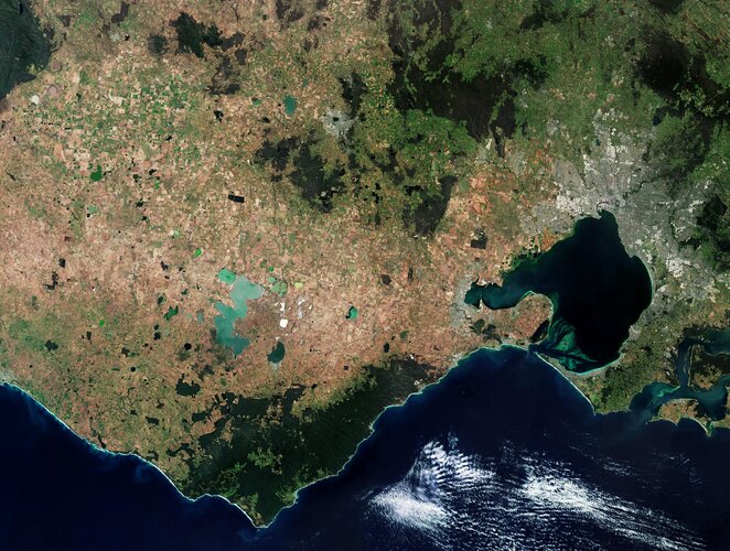 Image:
This Copernicus Sentinel-2 image features part of Victoria, a state in southeast Australia.
Image:
This Copernicus Sentinel-2 image features part of Victoria, a state in southeast Australia.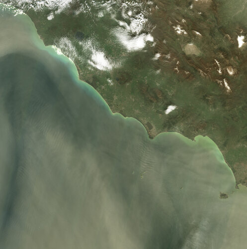 Image:
Images from the Copernicus Sentinel-2 mission show a large dust storm originating from the Sahara Desert that has engulfed skies across the central Mediterranean Basin.
Image:
Images from the Copernicus Sentinel-2 mission show a large dust storm originating from the Sahara Desert that has engulfed skies across the central Mediterranean Basin. 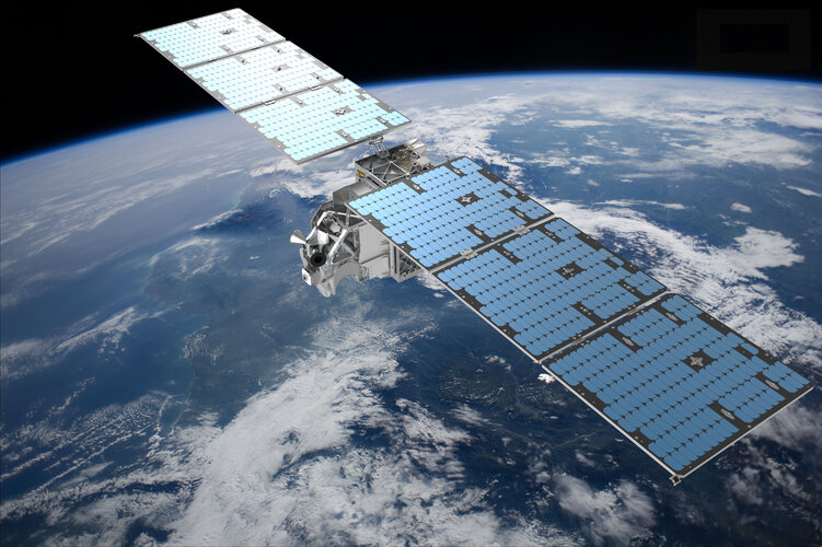
 Video:
00:17:57
Video:
00:17:57
 Video:
00:14:13
Video:
00:14:13
